Velocity Maps
A velocity map is a sampled 3D vector field over a terrain. At points across every tile, it stores a direction (toward a goal, with an optional per-tile radial component) and a speed. The local tile type, the surface grade, and the roughness slow the speed. Use a velocity map to author and visualize target-velocity fields for locomotion tasks, and as an input to velocity-tracking rewards.
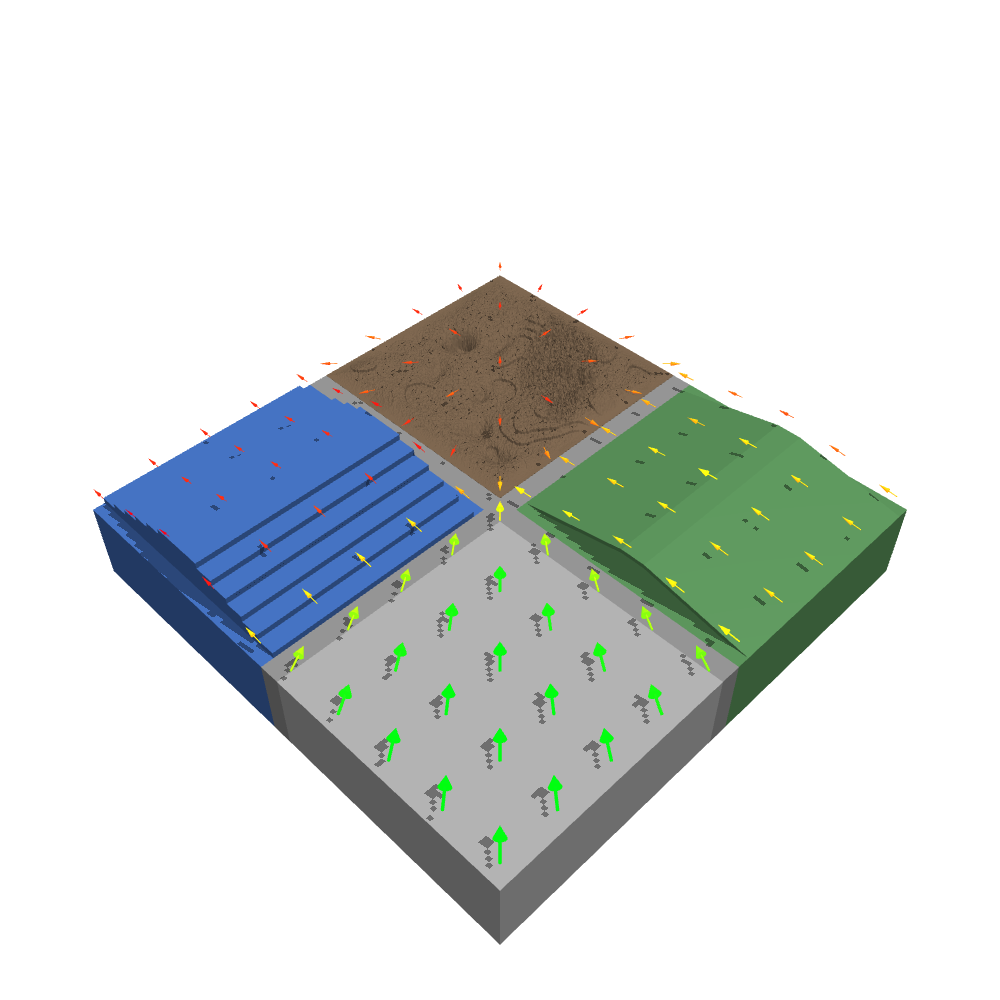
The subsystem has two modules:
myoassist_terrains.velocity_mapbuilds the field from aTerrainConfig. It needs no MuJoCo model. It requires a tiled terrain: sampling is per cell, and a uniform surface has none, so passing one is rejected with a message saying so.myoassist_terrains.velocity_arrowsturns a field into red-to-green arrow geoms for an MJCF scene.
Building a field
from pathlib import Path
from myoassist_terrains.config import load_config
from myoassist_terrains.velocity_map import generate_velocity_map

config  = load_config(Path("utils/configs/myoassist_base.json"))
samples = generate_velocity_map(
    config,
    start=(-10.0, -10.0, 0.0),
    goal=(10.0, 10.0, 0.0),
    samples_per_tile=8,
    mode="tile",          # "goal": every arrow points at the goal;
                          # "tile": add a per-tile radial component
)
# each sample is a VelocitySample: row, col, tile_type,
#   position=(x, y, z), velocity=(vx, vy, vz), speed
generate_velocity_map returns a list[VelocitySample]. The main knobs are:
| Parameter | Meaning |
|---|---|
start, goal | World (x, y, z). The horizontal direction points from each sample toward goal. |
samples_per_tile | Grid density per tile (n × n samples). 1 places its single sample at the tile centre. |
base_speed | Speed on flat terrain, before per-tile and grade scaling. |
speed_scale | Override the per-tile-type multiplier. The defaults come from the tiles themselves, each of which declares its own, so a custom tile registered with register_tile(..., speed_scale=...) is covered automatically (flat 1.0 down to gap 0.25). |
mode | "goal" (straight to the goal) or "tile" (blend in a radial component). |
tile_radial_mode | For mode="tile": "inward", "outward", or "mixed". |
smooth_speeds | Spatially smooth neighboring sample speeds. |
tile_speed_jitter, tile_jitter_seed | Deterministic per-tile speed variation in [1-j, 1+j], so identical tile types still read distinctly. |
height_offset | Lift samples above the surface for arrow placement. |
Surface heights come from the tiles themselves. Each tile reports its own, in the same module as the code that places its geometry, so the arrows sit on the surface the terrain actually has. For your own lookups use surface_height_at(config, x, y), which also handles uniform terrain and reports the height of the connector strips between cells.
Rendering arrows
add_velocity_overlay(worldbody, asset, samples, *, emission=0.0, color_bins=32) appends a shaft-and-cone arrow per sample to an existing scene’s <worldbody> and <asset>. The arrows do not collide (contype/conaffinity = 0). They are colored red (slow) to green (fast) across the observed speed range. Set emission > 0 to make them self-illuminate against the terrain. Call this function after the terrain and model geoms are in the scene, so the name-uniqueness checks pass.
Ready-to-run renderers
Two scripts under utils/render/ drive the above end to end. They need the [render] extra for mediapy.
# Terrain-only velocity overlay from a terrain config.
python utils/render/render_velocity_map.py \
    --terrain-config utils/configs/myoassist_base.json \
    --start -10 -10 0 --goal 10 10 0

# Terrain (with optional --arrows) and no musculoskeletal models; free or fixed
# camera. --emit-xml writes a viewer-ready scene instead of rendering.
python utils/render/render_terrain_check.py \
    --config utils/render/terrain5x5_velocity.json \
    --arrows --free --elevation -90 --distance 130